Miljevci
Miljevci or Miljevci plateau is a small region in Šibenik-Knin County in Croatia that includes seven villages. The plateau has an area of over 100 square kilometers and is located between the rivers of Krka, Čikola and mountain Promina. Miljevci are only a few kilometers from the town of Drniš in the east, and across the Visovac Monastery in the west. The majority of the population are Croats.
The villages of Miljevci have a total population of 1,096 (census 2011):
* Bogatić (population 94)
* Brištane (population 174)
* Drinovci (population 164)
* Kaočine (population 203)
* Karalić (population 108)
* Ključ (population 162)
* Širitovci (population 191)
* Drniš
The villages of Miljevci have a total population of 1,096 (census 2011):
* Bogatić (population 94)
* Brištane (population 174)
* Drinovci (population 164)
* Kaočine (population 203)
* Karalić (population 108)
* Ključ (population 162)
* Širitovci (population 191)
* Drniš
Map - Miljevci
Map


Country - Bosnia_and_Herzegovina
 |
 |
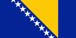
| Flag of Bosnia and Herzegovina | |
The area that is now Bosnia and Herzegovina has been inhabited by humans since at least the Upper Paleolithic, but evidence suggests that during the Neolithic age, permanent human settlements were established, including those that belonged to the Butmir, Kakanj, and Vučedol cultures. After the arrival of the first Indo-Europeans, the area was populated by several Illyrian and Celtic civilizations. Culturally, politically, and socially, the country has a rich and complex history. The ancestors of the South Slavic peoples that populate the area today arrived during the 6th through the 9th century. In the 12th century, the Banate of Bosnia was established; by the 14th century, this had evolved into the Kingdom of Bosnia. In the mid-15th century, it was annexed into the Ottoman Empire, under whose rule it remained until the late 19th century. The Ottomans brought Islam to the region, and altered much of the country's cultural and social outlook.
Currency / Language
| ISO | Currency | Symbol | Significant figures |
|---|---|---|---|
| BAM | Bosnia and Herzegovina convertible mark | KM or КМ | 2 |
| ISO | Language |
|---|---|
| BS | Bosnian language |
| HR | Croatian language |
| SR | Serbian language |